
Resources
Maps
Crude pipeline map
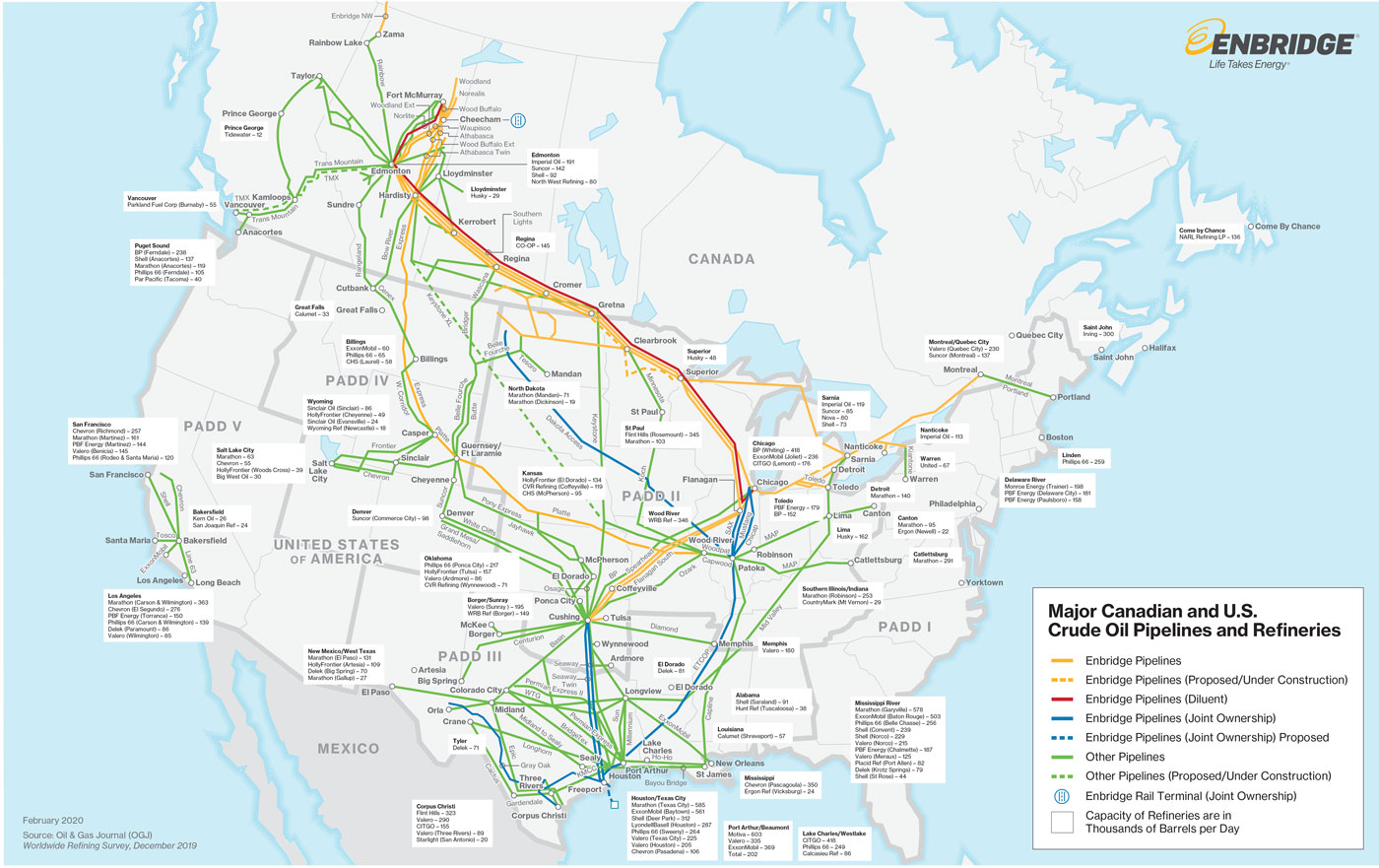
Download map (PDF)
Natural Gas map
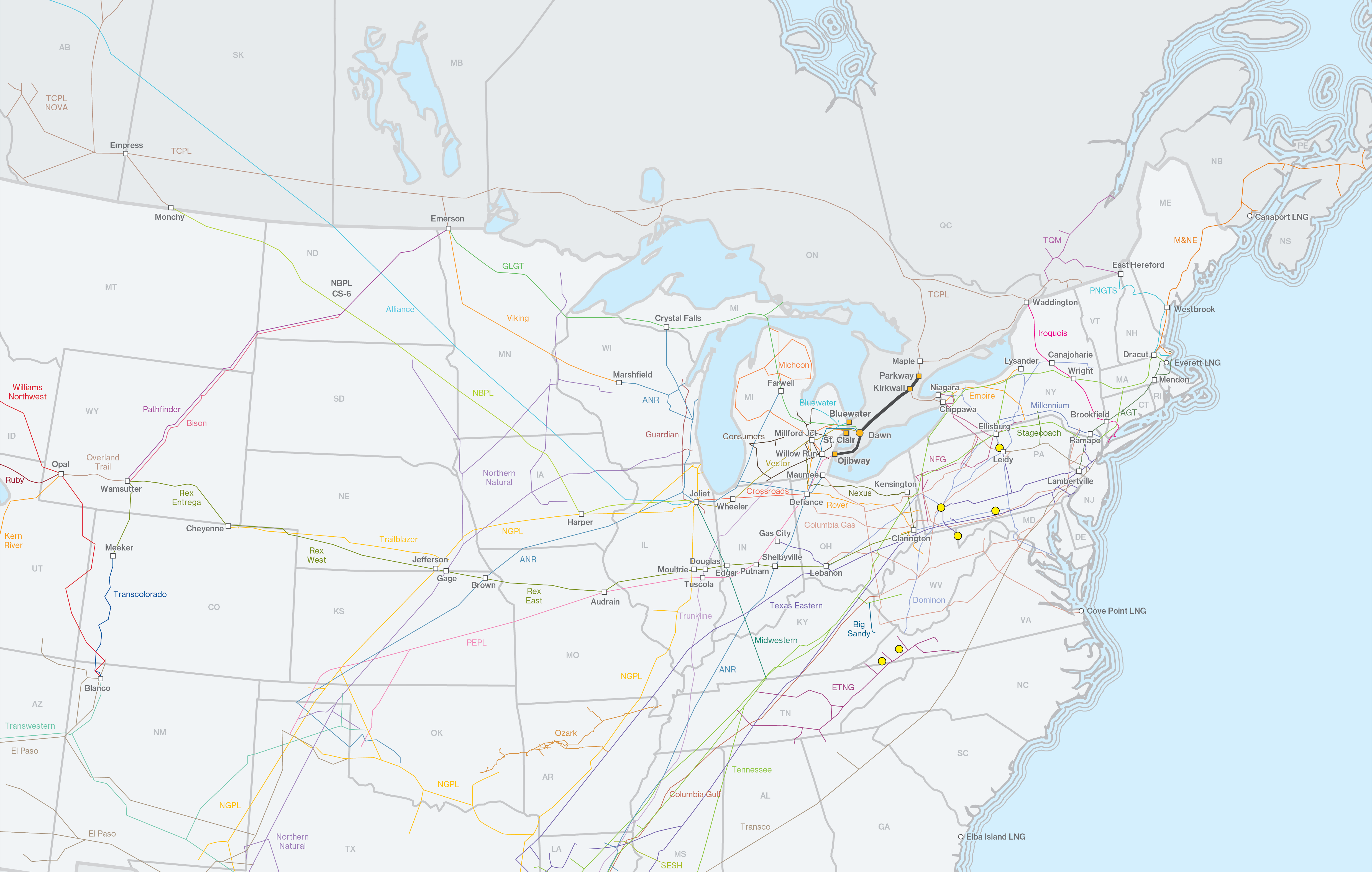
Download map (PDF)
Crude Facility Operations
Tidal's network of upstream facilities are strategically located across the production basins in Canada as well as North Dakota. We provide customers with flexible options and competitive pricing across our facilities.
In Canada
Tidal partners with producers and facility operators as a single shipper at the terminals listed below. Please reach out to our Producer Services team at producer.services@tidal-energy.com for more information on these facilities and the services Tidal can offer.
Producer Services map
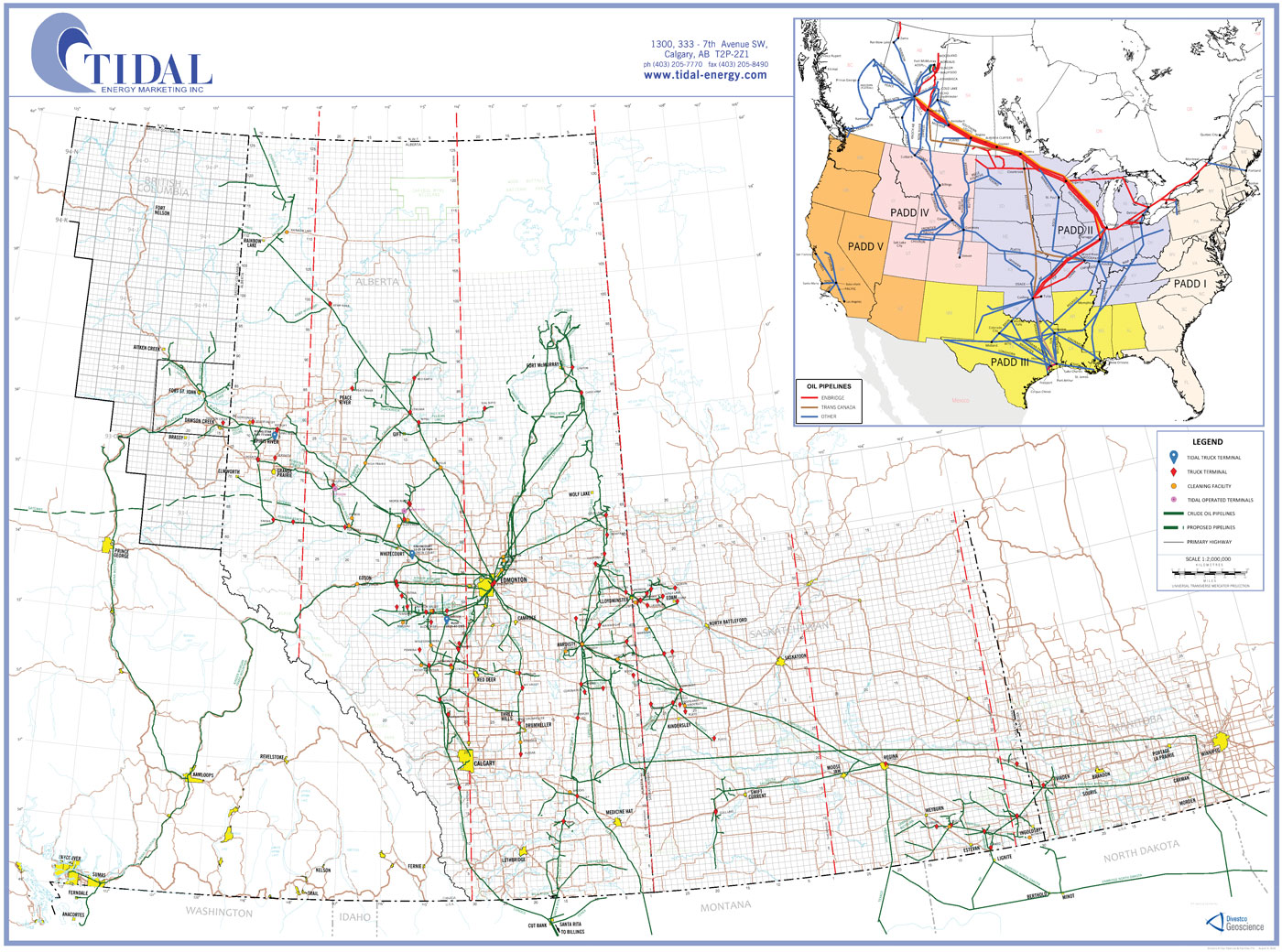
Download map (PDF)
|
Facility |
LSD |
Operator |
Services Available |
|---|---|---|---|
|
AOC HANGINGSTONE |
13-19-086-09W4 |
Athabasca Oil Corporation |
|
|
MARLBORO YOUNGSTOWN |
06-25-031-10W4 |
Marlboro Energy Ltd. |
Treating Emulsion and Water Disposal |
|
PERSIST WAYNE |
01-20-028-21W4 |
Persist Oil and Gas Inc. |
Treating Emulsion and Water Disposal |
|
RUSH BRETON |
10-35-047-04W5 |
Rush Energy Services Inc. |
Custom Treating, Emulsion Water Disposal, Clean Produced Water Disposal |
|
BROADBILL GREENCOURT |
12-29-058-09W5 |
Broadbill Energy Inc. |
Treatment, Recovery and Disposal |
|
VERMILION CYNTHIA |
15-16-051-11W5 |
Vermilion Energy Inc. |
Treating (Sweet) |